Running Routes in the Cairngorms National Park
After being asked by numerous people over the years ‘where can I go running? I thought I’d better offer some suggestions. I’d done a similar list for Visit Cairngorms a few years ago, so this is a jazzed-up version with some bells & whistles.
Here are some ideas on where to go & how far/flat or hilly it might be. These routes are in no particular order & there are many other places to go running/walking or biking.
Hopefully, these will help people get outside & enjoy this magnificent area we live in, It has such variation, from short easy-going Loch side runs to mammoth amounts of Munro bagging runs, you can literally head out on a trail & be gone for hours on end & hardly see anyone. There’s always a guarantee of seeing the best of nature & wildlife from Osprey to Reindeer!
All of this combined with time to clear your head makes running a therapy that folk would pay a small fortune for, yet it’s an incredibly inexpensive sport/passion to get into, so get outside & keep moving everyone.
All of the below routes have parking available at the start point & some have public transport.
As with all trail runs care should be taken along with the correct gear & planning, especially with the weather in mind. If you need any advice on how to prepare for off-road running, then, please check the following Hill Running Safety.
The trail/hill runs below are only suggestions & are done entirely at your own risk.
Loch an Eilein - 5.5k
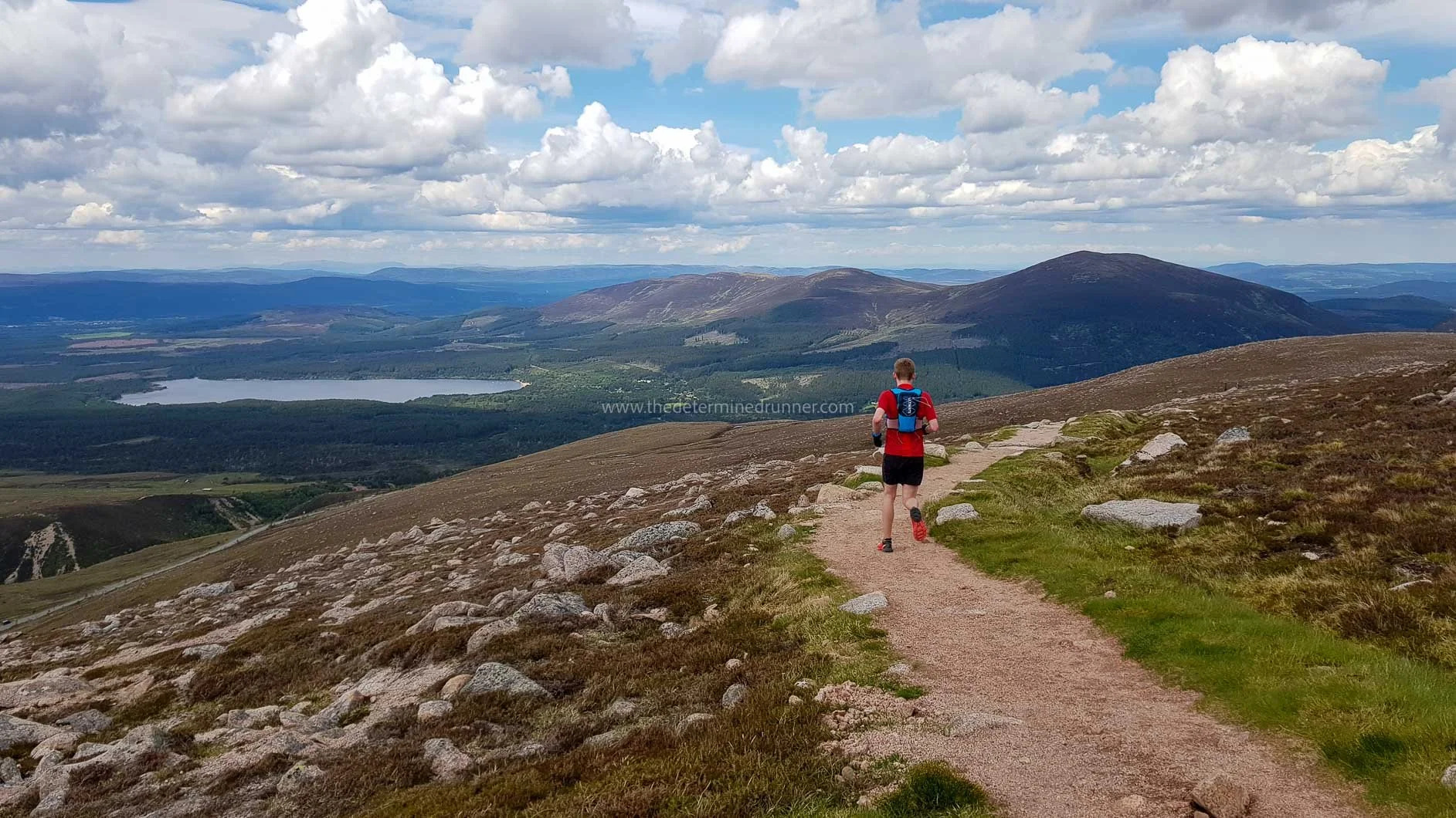
Meall a Bhuachaille - 8.9k
Creag Bheag - 5.3k
The Fara - 21.6k
Loch Morlich - 5.5k
Loch Einich - 21.2k
Northern Corries - 10k
Coylumbridge Loop 15.9k
Loch Garten/Loch Mallachie - 7.5k
Sluggan Bridge Loop - 9.3k

Loch an Eilein - Aviemore
Distance - 5.5km
Elevation - 57m
This is a fairly flat path with some undulations.
You can extend the run by taking trails that lead off at points, but don’t worry it’s a straightforward path if you just want to run the loop. Heading off in the opposite direction gives a very different experience, so be sure to try both directions!
Things to see along the way, the main attraction is the ruin of a small 14th-century castle on its own island.
Parking is available at a charge at Loch an Eilein.

Meall a Bhuachaille - Glenmore
Distance - 8.9km
Elevation - 557m
Good path but steep in sections.
On the map here I started at Glenmore Lodge but you can just as easily start in Glenmore itself.
If you take the anticlockwise route the steepest section will be going up (which I think is the safer option when running).
Things to see along the way - An Lochan Uaine, otherwise known as The Green Loch. Incredibly picturesque, be sure to take a camera! Also, the views all around on this route are jaw-dropping, from the bottom all the way to the top & back down again!
Free Parking is available at Glenmore but limited during busy periods.

Creag Bheag - Kingussie
Distance - 5.3km
Elevation - 284m
Good paths, steep 1st section through the trees.
If you take the clockwise route, this will take you up through the trees, excellent views at the top, looking down over the golf course.
Things to see along the way - Keep an eye out for red squirrels through the trees. Climbers crags are off to the right near the top & there’s a bench to relax & take in the views!
Free Parking is available at the Ardvonie Car Park.
The Fara - Dalwhinnie
Distance - 21.6km
Elevation - 1,105m
A mixture of paths, from thin single track to wide forestry track.
Steep section towards the beginning that gains most of the height.
Once at the top, there is a large cairn, from there you run along the ridge, very wide & no exposure. Long flat wide path to return home, that lacks the excitement from running along the tops.
Depending on the weather it can be very windy along the top & the 1st ascent can be boggy when wet.
Things to see along the way - The view running along the top running parallel to Loch Ericht is fantastic!
Free Parking is available at the small car park before the level crossing at Dalwhinnie.

Loch Morlich - Glenmore
Distance - 5.5km
Elevation - 17m
Hardpacked wide paths most of the way round.
You can extend the run by sticking to the main path the whole way round, (which brings you out at The Hayfield), this will add approx 1-2k to the run if you wish. On this run, I chose the path that hugs the loch a little more.
Things to see along the way - Great views across the Loch towards the Cairngorms when you are next to the road section.
Free Parking is available, though busy in peak season.
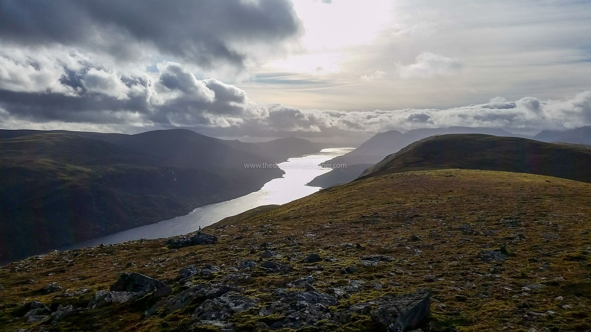
Loch Einich - from Whitewell (Aviemore)
Distance - 21.2km
Elevation - 379m
One of the best routes in the Cairngorms National Park!
A true feeling of being in the middle of nowhere, very isolated towards the Loch, which brings a feeling of truly being out in the wilderness.
A hard-packed trail with a high & low option at the midpoint, both routes rejoin each other soon enough. Take the high route for views & the lower route to see the river up close (you can even go for a dip if it’s a hot day).
There is a slight uphill going towards the Loch but so slight, that you hardly notice it. Whilst on the return back, the downhill is a welcome treat.
Things to see along the way - Remote spectacular views!
Out & back route
Parking is free but very limited at Whitewell (Upper Tullochgrue).

Northern Corries - Cairngorm
Distance - 10km
Elevation - 713m
A spectacular route with stunning views.
As with any mountain running, care should be taken along with the correct gear & planning, especially with the weather in mind.
Surprisingly good trail for those used to hill running, once on the top, a good section is relatively flat.
Can be run clockwise or anticlockwise, though I normally do it anticlockwise.
Things to see along the way - Looking down towards Loch Morlich & don’t get too close to the edges! It’s a long way down!
Parking is available at Cairngorm Mountain at a charge.
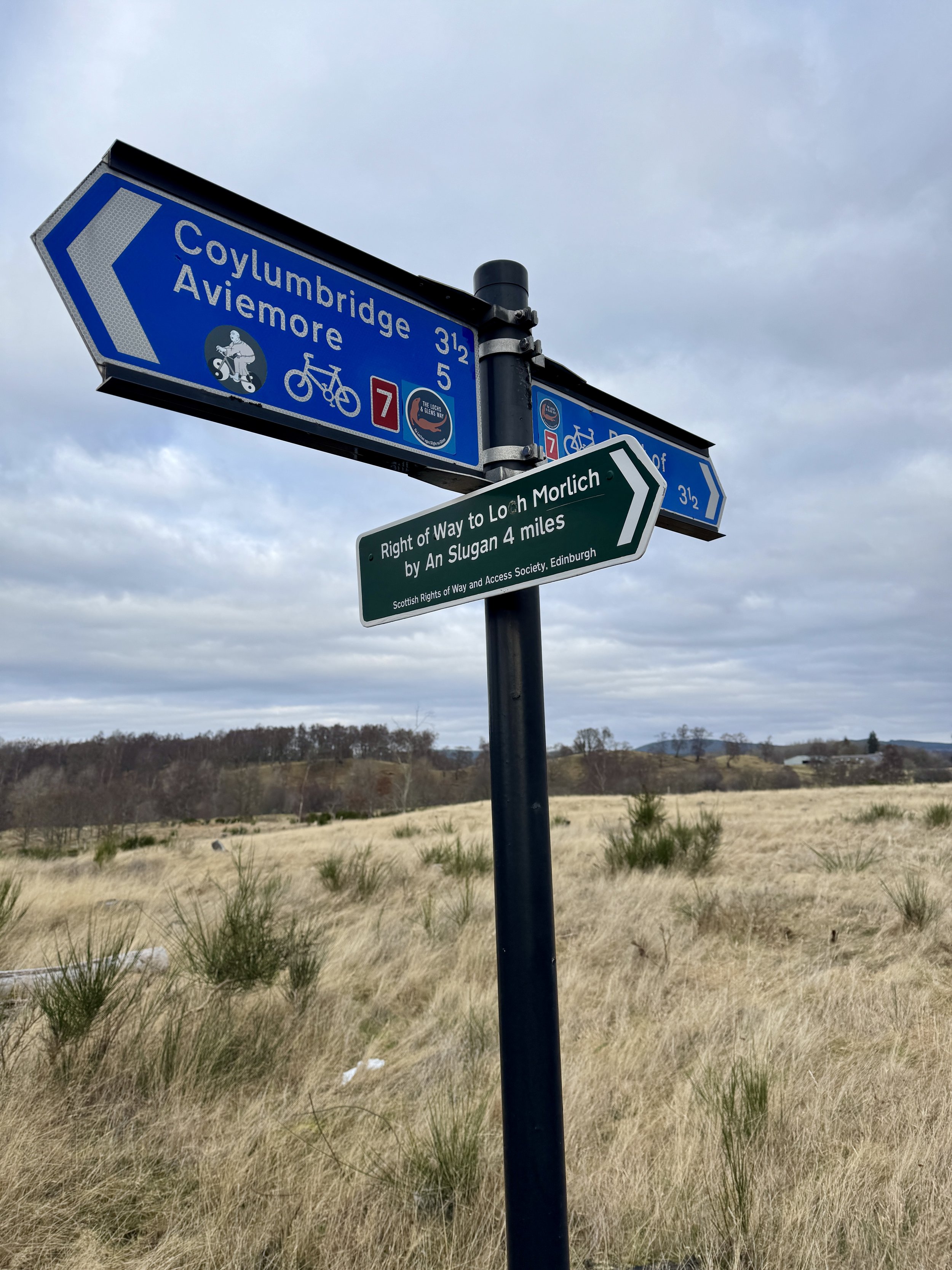
Coylumbridge Loop via An Slugan - Aviemore
Distance - 15.9km
Elevation - 194m
A great option if you want some road & some trail. Most of this route is quiet & you don’t normally bump into anyone until you join the Old Logging Way on the return.
The road section heads along the picturesque back road from Coylum towards Boat of Garten, this part is 5.7k.
You then turn right when you see the sign in the picture.
You now have a 3k incline up the hardpacked trail, before you start going down the other side with views of the Cairngorms opening up as you run.
You eventually link up with the Old Logging Way & run back to where you started.
Things to see along the way - Loch Pityoulish, forest trails & the Cairngorms.
Circular route.
Parking is free on the roadside by the Coylum Campsite.

Loch Garten/Loch Mallachie Loop - Boat of Garten
Distance - 7.5km
Elevation - 79m
Mostly narrow forest trails.
The start is at the car park when you have left Boat of Garten & head towards Nethy Bridge (at the T Junction).
A nice run that skirts past both Loch Garten & Loch Mallachie.
Can be run clockwise or anticlockwise, though I normally do it clockwise.
Things to see along the way - If you are lucky, Ospreys! & sometimes Squirel’s.
Free Parking is available at Abernethy National Nature Reserve Car Park.

Sluggan Bridge Loop - Carrbridge
Distance - 9.3km
Elevation - 158m
Decent paths, can be a little wet with puddles after heavy rain, 2 small road sections.
A real sense of being out in a remote part of Scotland, very calming.
Wonderful views along the route including Sluggan Bridge that was built by General Wade as part of a military road.
Depending on the weather it can be windy when you come out from the trees.
Things to see along the way - Moorland & Hills, lovely views.
Free Parking is available next to the gate at the start/finish.